1. Pico del Teide
Teide mountain is the highest peak of Spain with 3715m above sea level and of course an inactive volcano. It offers a great view over the whole islands (if you’re lucky enough to go on a clear day). At the top you can also enjoy the smell of sulphur gases escaping from some cracks in the ground that remind of the volcanic past. If you’re a hiking enthusiast you can of course hike up to the peak, otherwise there’s also a cable car. Beware that it is a national park, which requires permission to hike up to the peak from the cable car top station.
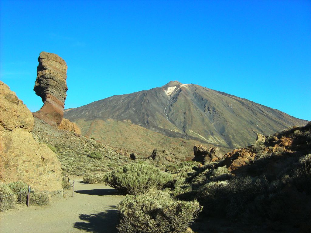
2. Canadas del Teide
The Canadas are the area surrounding the peak of mount Teide, formed by volcanic activity some (million years) time ago. It’s basically a plain of cooled down magma, that formed the old crater. It offers plenty of interesting hikes around different rock formations like the ‘cathedral’, which are vertical lava formations. Probably the most well-known one is the so-called ‘thumb’ formation.
3. Anaga mountains
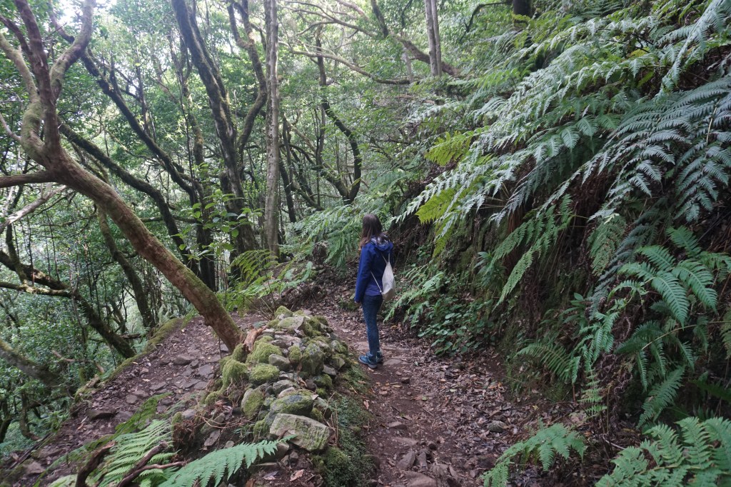
Now this is something completely different to the earlier mentioned rocky-volcanic environments. The Anaga mountains lie on the north-east side of Tenerife and get a lot of rain during the year, which allows a lush forest to grow. The laurel forest is endemic to some islands of Macaronesia (comprising of the islands of Azores, Madeira, the Canary Islands and Cape Verde). With all the lichen growing on the trees it creates a very magical feeling and is also called the ‘enchanted’ forest. Plenty of hikes are possible here.
In another part of the Anaga mountains you find some terrace structures that were (and still are) used for growing crops. They are carved into pretty steep hill faces and remind one of the terraces you see in Peru. You can also find some cave-homes carved into the mountains, some of which are still inhabited to this day.
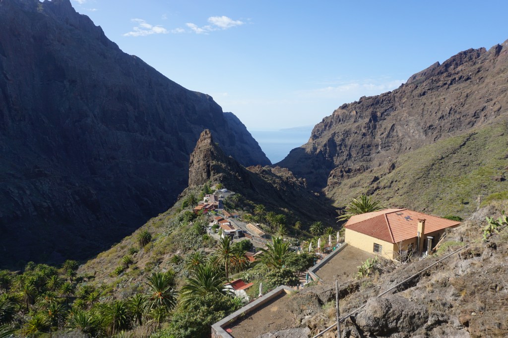
4. Teno mountains
Right on the other side of the island the Teno mountains are much scraggier, but not less interesting to hike. The rugged rocks form very steep cliffs and amazingly folded structures. The famous Masca valley is located in the Teno mountains. Here you can hike down one valley from the top in the Teno mountains to the bottom, where it meets the ocean (pre-booking required). In the outermost point the Teno mountains end in the Punta del Teno.
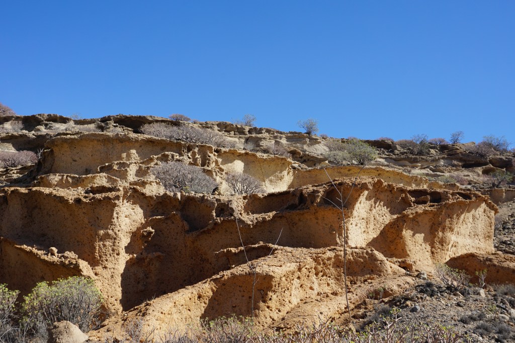
5. Southern Tenerife
This part of the island is the drier part and is characterised by almost bare volcanic rocks, dotted with some green bushes (more or less depending on the season). You can find a lot of smaller volcanos popping out of the landscape like the Montana Roja (the red mountain, which does justice to its name) or the Mt. Pelada. Hiking around here you come across a wide variety of different rock formation like waves and arches. The view of green bushes in contrast to the backgrounds of yellow, red or black volcanic rocks is pretty interesting.
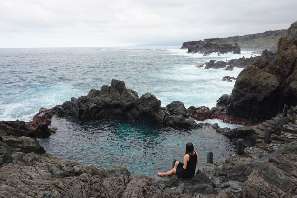
6. Northern Tenerife
The northern part receives much more rain is therefore much greener. The northern flank of Mt. Teide offers some hiking in green surroundings. Furthermore, the cliffs drop much steeper here than in the south, which creates a very different environment with big waves hitting the roughed rocks. In some places however you will find the so-called ‘Charcos’; natural pools formed by the volcanic rocks and filled with sea water. Pretty nice to have a swim, if the sea is too turbulent (however, check the conditions, they can be heavily flooded by big waves too).

Hinterlasse einen Kommentar